Our data processing engine is specifically designed to:
• Merge multiple ADCP/GPS exported data files from a river survey (Matlab format for SonTek ADCPs, ASCII format for TRDI ADCPs) to produce a complete sample set of geo-referenced depth and 3D water-profile velocity data for processing.
• Screen and QA ADCP/GPS data based on preset criteria to remove depth and velocity outliers.
• Calculate a unique geo-referenced beam depth for each ADCP depth beam in order to provide a more precise depth position.
• Convert ADCP/GPS moving-boat data from multiple systems agnostic of brand of instrument
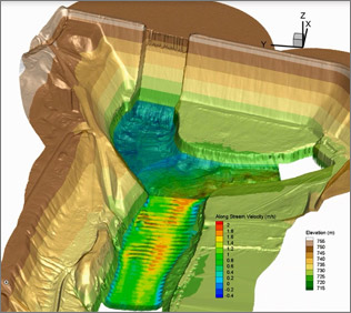
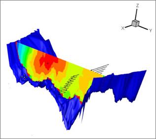
• Interpolate the resulting 5-beam elevation samples into a regular, gridded elevation points throughout the river boundaries. The elevation grid “resolution” is adjustable as needed.
• Compute depth-averaged velocity throughout the reach.
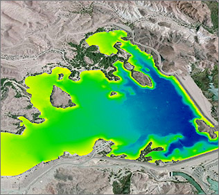
• Provide a series of graphical data outputs based on the processed data to show relevant elevation topography and velocity patterns along the surveyed river reach.
WaterCube has developed a proprietary data processing engine that can apply to many applications, including:
Below are four specific cases featuring our data processing engine:


![]()